Planning a Trip or Day Tour – Part I
Most day trips in North America are simple enough to forego detailed trip planning. If it doesn’t work out, well, you can always just follow your skin track back to the trailhead. Guidebooks and local knowledge are the best navigation tools out there, as someone has already made all of the mistakes for you. If there is a guidebook to an area, use it! That said, they can be notoriously inaccurate (like the one I wrote...) as the author may be so familiar with the terrain that they focus on minute details and leave out the large ones.

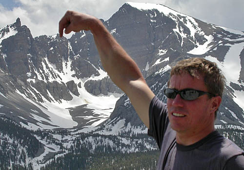
Simplicity is part of the beauty of day tours – it’s as easy as point n’ chute like the photo above. Derek Weiss pointing out the Cortex Couloir, Great Basin, Nevada.
Some areas have a strong and misguided ethic of not reporting descents, discouraging visitors, giving out false information and harassing any attempts at a guidebook. These regions are generally not nearly as good as the locals seem to think they are and it’s their loss. What goes around, comes around.
On longer tours or multi day trips, the penalty for poor planning is getting lost, benighted or suffering through poor terrain. Trip planning is not hard, but it does take time, especially to do it correctly. Maps and photographs are the basic tools of the trade and a good place to start.
______________________
For 15% off The Chuting Gallery – A Guide to Steep Skiing in the Wasatch Mountains from Backcountry.com, click the photo below…
Category: 10 Navigation


Or you could put a gps on your dog and use that to figure your way back to the trail head.