Wasatch Conflict Primer 101
It is hard to live in the Salt Lake City area for more than year or so and not have an opinion on what should, or shouldn’t, happen here in regard the Wasatch Mountains. To outsiders, it might seem like there are a lot of turf and class battles going on, which would indeed be the case. Some things are worth fighting for. Welcome to the Wasatch – now choose a side.
As a starting point, the vast majority of contention is focused around the Central Wasatch Mountains, which by almost any standard is a tiny little mountain range. If you envision the knuckles on your hand being the ski resorts and your fingers as the major canyons leading up to them, you start to get an idea of the lay of the land. There are seven major resorts in the Central Wasatch (Snowbird, Alta, Brighton, Solitude, Deer Valley, Park City & the Canyons) and they are either virtually adjacent to each other, or within a snowball throw. Skiing all seven of them in a day, either with or without lift assistance is no big deal.
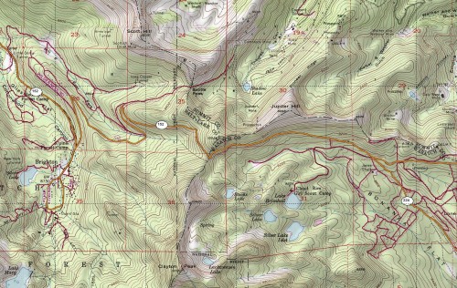
To intensify this crowded situation, the skiing starts at about 7,000′ and the Wasatch tops out at a bit over 11,000′, which means there is a 4,000′ band of prime terrain. Although Utah is a large state, when “The Greatest Snow on Earth” is mentioned, 90% of the time it is referring this tightly clustered group of peaks located within this narrow elevation range. It is tiny to the point that topo maps are almost irrelevant, overnight camping is only done for the novelty of it and very few people ever get lost or benighted. If the sun starts setting, ski down the fall line and be careful not to get hit by a car when you reach the road. Technically, the Wasatch Mountains cover roughly 180 miles from Mt. Nebo in the south almost all the way up to the Utah/Idaho border, but most of this area lacks roads that are maintained in the winter and mountain townships (like Alta, Brighton & Park City), so access is difficult.
To thicken the plot, the Central Wasatch Mountains fall under three different counties – Salt Lake County, Summit County and Wasatch County. The landmark Tri County Peak is located between Brighton and Park City right off of the Guardsmans Pass road. You might wonder if all of these counties could work together for a common Wasatch, but the short answer is “no.” Salt Lake County has the lions share of the Central Wasatch (Little & Big Cottonwood Canyons) and their main concern is maintaining quality drinking water for the Salt Lake Valley. Summit County (Park City, Deer Valley & the Canyons) is mainly a rural and has never met a developer it didn’t like. Wasatch County (Heber) has other things to worry about than plowing high elevation snow-caked roads for people who don’t spend money in their jurisdiction.
And we are just getting started. ;)
Unlike the Tetons and Yosemite Valley which were immediately recognized and protected for their scenic beauty, the Wasatch has a history of being a utilitarian range and has been used for mining, lumber and quarrying ever since ol’ whitey showed up. It was only when skiing started to take off here about 60 years ago that anyone really cared about the aesthetics or accessibility of the range. However, by then much of the range had been divvied into mining claims whose value has gone from zero to infinity and back again many times over. At some point in the timeline the Forest Service, became major landowners as well. The end result is that today’s Wasatch Mountains are a fragmented swamp (not quite a quagmire) of public and private lands that are overseen by a variety of agencies and interests. And user groups.
In the late 1970’s and early 80’s, three Wilderness areas where added to the Wasatch mix. This effort was spearheaded by a group of far sighted individuals who later went on to form Save Our Canyons, a group dedicated to preserving the Wasatch environment. Nowadays, with the exception of a certain heli skiing company, the Wilderness areas are universally loved and appreciated to the point that another one is being considered. However, an unintended consequence of the Wilderness areas has been that they put even more pressure on any available land which might be potentially developed, including expanding onto Forest Service land.
The end result is where we are today. Areas that are private property can and will continue to be developed, which is hard to argue with. If I had devoted more time to managing my hedge fun (<— joke) instead of skiing, I could have bought these lands up and turned them over to the public, but I didn’t. Public lands on the other-hand are becoming far more controversial, which is why you have people lining up and protesting every time a ski resort even suggests putting a Coke machine on them. The Central Wasatch is seemingly shrinking before our eyes.
Category: Wasatch Mountains






Andrew what is the best way to prevent the shrinkage? Really I totally agree with you about the problem, but really don’t know the best way to prevent it. Save our Canyons?
There is plenty of ski resort capacity in the Wasatch, and this whole thing reeks of a plan to try to get the Canyons some economic traction for its ongoing, harebrained development scheme.
Resorts/Developers should pay a tax for the public transportation so sorely needed in all the canyons of the wasatch. This would fix the car problems, and would begin to offset the immense indirect cost freebees enjoyed by the resorts/developers.
Hi Matt – Personally, I think two things should/could happen.
1) The state/counties/cities should buy up some of the private land and make it public. This idea immediately runs into problems as the real estate prices have gotten so high. For instance the proposed Treasure Hill development in Park City was recently offered to the public at something like 50 million dollars and it is a relatively small amount of acreage. A price tag like that is out of the question for a small town, but at some point it seems like something has to be done. When the city of Boulder, CO bought up all of the land around it, I’m sure the price tag seemed high, but years later, it probably seems laughable.
2) The Forest Service should stop allowing resorts to expand onto public land and the resorts should be held to their current boundaries. If they can expand onto public land, so be it, but it makes me sick to my stomach to go to a resort and see all of these empty high-speed quads spinning around and then hear the resorts complain that they can’t be viable/profitable unless they are allowed to further expand.
“Technically, the Wasatch Mountains cover roughly 180 miles from Mt. Nebo in the south almost all the way up to the Utah/Idaho border, but most of this area lacks roads that are maintained in the winter and mountain townships (like Alta, Brighton & Park City), so access is difficult.”
Coming from a guy that will fly for 18+ hrs and than ride on a boat for a week to ski in the Artic? Hard to imagine you complaining about lack of access…sounds like this is the zone to explore in the Wasatch. Curious, of the entire Wasatch, what percent is “developed”? Or is it that just the places you like to ski are developed?
Sorry, devils advocate is an easy position to take…
Smokey – As a rough estimate, let’s say the Wasatch Range is 180 long by 15 mile wide, or 2,700 square miles. The Central Wasatch, which I’d define at the rectangle defined by I-15 on the West, I-80 on the north, Hwy 240 to the east and AF Canyon to the south, is roughly 20 x 20 miles, or 400 square miles. So, maybe 15%? But, what makes this 15% so desirable is that the best terrain and elevations for skiing. I look straight across at an 7,500′ peak out of my house and have never skied it as it is covered with scrub oak. There is good skiing around the Logan, Odgen and Timp areas, but aside from Snowbasin, these areas don’t seem nearly as developed, in a commercial sense, as the central wasatch.
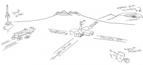
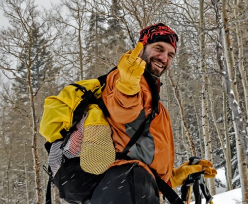
I was distracted from this serious topic with the presence of Wasatchius Localimus Flipemoffimus. But, upon closer inspection, the schematic depicting Susan in the West Desert is much funnier.
thanks Andrew, this is the best post ever written on the Wasatch Skiing situation. I’ll be referring to this for some time to come. Good luck down there. And I should add, the Wasatch seems like prime terrain for an access focused non-profit land trust that could begin buying up the prime private parcels with both private and public funds. There is a lot of money in those valleys, I’d be nice to see it put towards something decent.
Another interesting fact. “85% of Utah’s population live within fifteen miles of the Wasatch”.
That made me throw up on my mouth a little bit…
This fact alone showcases the potential conflict ya’ll have to deal with down there.
Good article on the situation. Crowding or perceived crowding is frequently only a matter of limited access. That’s often the situation here in Colorado. I’d imagine you still have plenty of uncrowded terrain that’s hard to get to. But yeah, the European level numbers one experiences in the Wasatch these days on anything halfway accessible is stunning to behold.
And even in Europe, you can still get away from the crowds if you walk farther, and don’t go to the quite so popular places.
A small edit: “Summit County (Park City, Deer Valley & the Canyons) is mainly a rural and has never met a developer it didn’t like. __Which might be why I have a house to live in, but that’s another story.” (grin)